(Photo by Calvin Shepherd - Use By Permission)
Alderson West Virginia - A History

© Property of Min7th Productions 2012
The Greenbrier River
In
the
development
of
any
civilization,
having
a
source
of
water
was
critical.
It’s
no
doubt
the
people
who
settled
in
the
vicinity
of
Alderson
chose
the
location
because
of
the
river.
The
native
Americans
were
probably
the
first
to
see
it
and
the
Lenape
natives
called
it,
“Onepake”
(O-ne-pa-ke),
for
Dark Path.
The
sources
of
the
Greenbrier
are
two
streams,
the
East
Fork
Greenbrier
River
and
the
West
Fork
Greenbrier
River
at
Durbin,
West
Virginia.
It
flows
for
173
miles
to
the
New
River
at
Hinton,
West
Virginia.
It
goes
through
Pocahontas,
Greenbrier
and
Summers
Counties,
past
several
communities
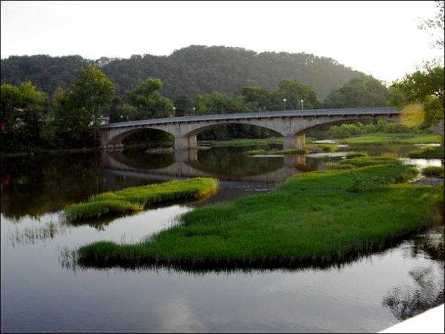
including Cass, Marlinton, Hillsboro, Ronceverte, Fort Springs, Alderson, and Hinton.
Before
the
coming
of
the
railroad,
Alderson
had
no
bridge
and
the
river
was
crossed
by
boats
or
fords
using
wagons,
horses,
or
on
foot.
Freight
had
to
be
shipped
in
from
the
east
by
large
flat
bottom
boats
called
“batteaus”.
These
long,
flat
bottomed
batteaus
were
typically
between
40-60
feet
long,
6-8 feet wide, and created for the purpose of transporting goods in shallow water.
In
1812
a
survey
expedition
led
by
Supreme
Court
Justice
John
Marshall
to
establish
a
river
route
connecting
the
James
River
near
Lynchburg,
VA,
and
the
Kanawha
River;
this
included
a
section
of
the
Greenbrier
River
from
Caldwell
to
Hinton.
Forging
the
route
would
enhance
trading
and
commerce between the East and the Ohio River Valley.
The
22-member
commission
departed
from
Lynchburg
on
September
1,
1812,
into
uncharted
waters.
Only
John
Marshall
and
one
other
crew
member would complete the entire, month long trip.
The
crew
traveled
up
the
James
and
Jackson
rivers
to
the
base
of
the
Allegheny
Mountains.
They
portaged
the
Batteau
by
wagon
over
the
Alleghenies
to
the
mouth
of
Howard’s
Creek
at
Caldwell,
where
they
put
in
on
the
Greenbrier
River
on
the
18th.
A
late
summer
drought
left
the
water
level
quite
low
in
the
Greenbrier,
and
it
took
the
expedition
10
days
to
reach
the
mouth
in
Hinton.
They
spent
the
night
of
September
28
on
one
of
the
islands
at
the
confluence
of
the
Greenbrier
and
New
rivers
and
began
the
last
section
of
the
expedition
down
the
New
on
the
29th.
They
reached
their
destination,
the
mouth
of
the
New
at
the
Kanawha
River,
on
October
9,
1812.
The
canals
slated
to
trace
Marshall’s
route
was
never
completely
finished
due
to
funding
issues
and
the
development
of
railways,
which
was
a
move
efficient
and
economical
means
of
transportation.
However,
some
of
the
canals
were
dug
out
and
the
path
he
forged
was
used
in
the
creation
of
the
railway,
U.
S.
Route
60,
and
Interstate
64.
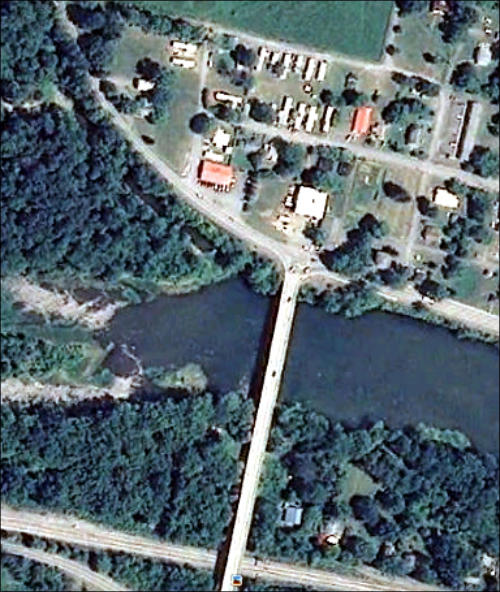
The
photo
to
your
left,
shows
an
aerial
view
of
one
of
the
batteau canals, left of the new bridge, following the curve of the highway. (Click on photo for larger view)
Main Index
The contents contained on this page is copyrighted and the sole property of Min7th Productions.
The History of Alderson, West Virginia
From Multiple Sources and Photos - Compiled and Edited by Barry Worrell
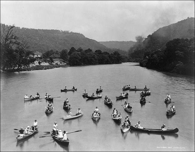
Naturally
the
river
was
used
for
recreation
by
the
town
and
also
Camp
Greenbrier,
a
camp
for
boys,
which
was
established
in
1893.
Using
the
river
for
recreation
was
part
of
Camp
Greenbrier’s
curriculum.
Not
only
did
this
boys
camp
use
it
for
swimming,
they
also
use
it
for
canoeing.
Even
today
it’s
not
uncommon
during
the
summer
to
see
an
group
of
canoes
from
the
camp
heading
west
toward
the
bridge
and
back.
(From
the
angle
of
the
photo,
it
appears
to
be
taken
from
the
opposite
bank
of
the
river.
1910
photo
by
J.
W.
McClung,
Click
on
photo
for
larger
view)
Canoes
on
the
Greenbrier.
Camp
Greenbrier
boys
assemble
before
the
eye
of
Mr.
McClung’s
camera
in
this
photo
he copyrighted in 1907. Much smoke and commotion is being raised by a train invisible behind the trees at right.
The
alternate
swimming
hole
was
Rock
Bar,
which
is
about
a
mile
east
of
the
edge
of
Alderson.
The
river
there
has
lots
of
shallow
water
and
deep
water
for
all.
Unlike
the
river
in
the
city
limits,
Rock
Bar
has
plenty
of
room
to
sun bathe and lite a fire to cook out. This photo taken circa late 1940s. (Click on photo for larger view)
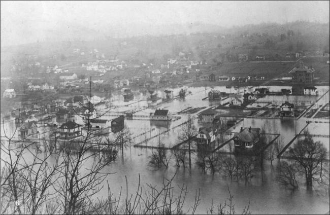
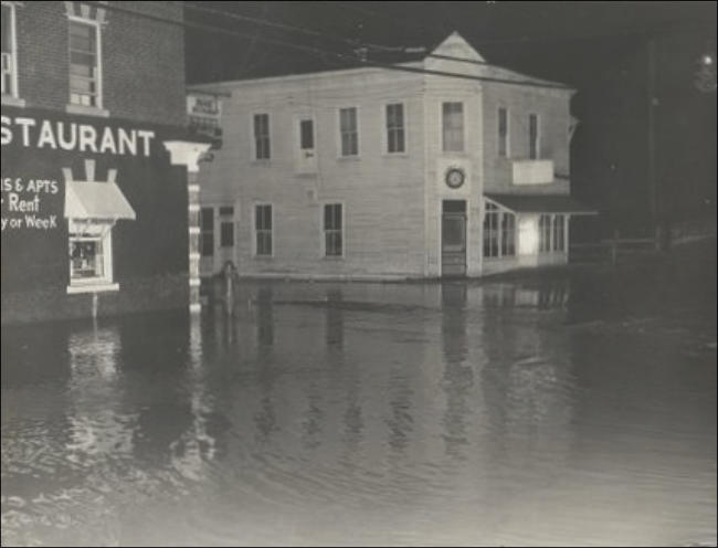
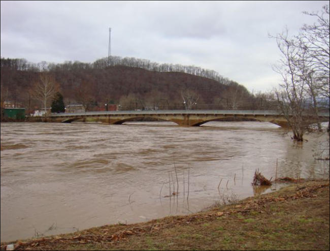
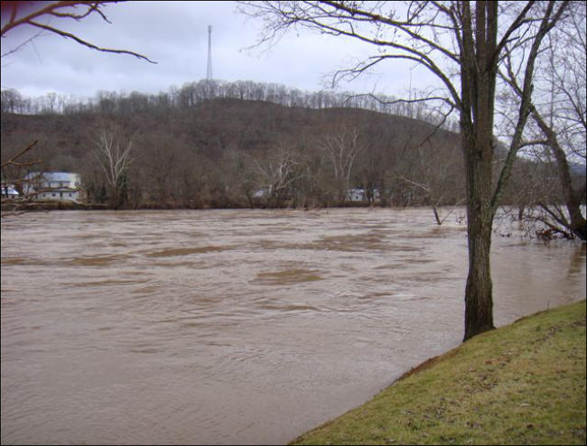
Several
miles
up
stream
from
Alderson,
when
there
is
too
much
rain,
melting
of
snow,
or
a
combinations
of
both,
the
river
has
a
tendency
to
flood.
Normally,
the
river
levels
are
changing
constantly,
however
since
1963
there
have
42
recorded
incidents
of
flooding
in
Alderson
with
water
levels
over
11
feet.
Five
of
those
were
over
19
feet,
which
is
major
flood
conditions,
with
damage
to
homes
and
property.
So
far,
the
record
for
flooding
was
in
1985
and
1996,
where
waters
crested
to
23.95
feet
and
24.33
feet.
Frequently
basements
will
fill
up
and
mud
and
silt
are
left
to
shovel
out.
On
the
other
hand,
during
the
dry
periods,
there
have
been
several
times
when
the
low
water
levels
have
been
below
2
feet.
(Click
on
photos
below
for
larger
view)
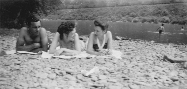
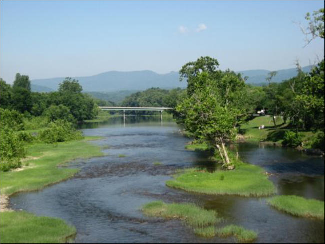
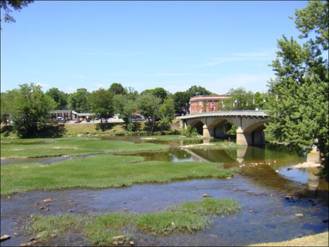
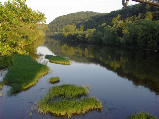
As destructive and dangerous the river can be, it also is serene and absolutely beautiful. Summer brings excellent swimming, fishing, boating of just
enjoying the view.
(Click on photos below for larger view)
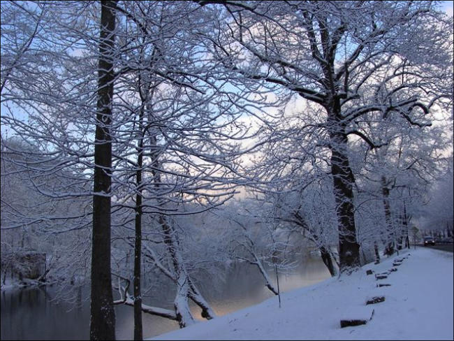
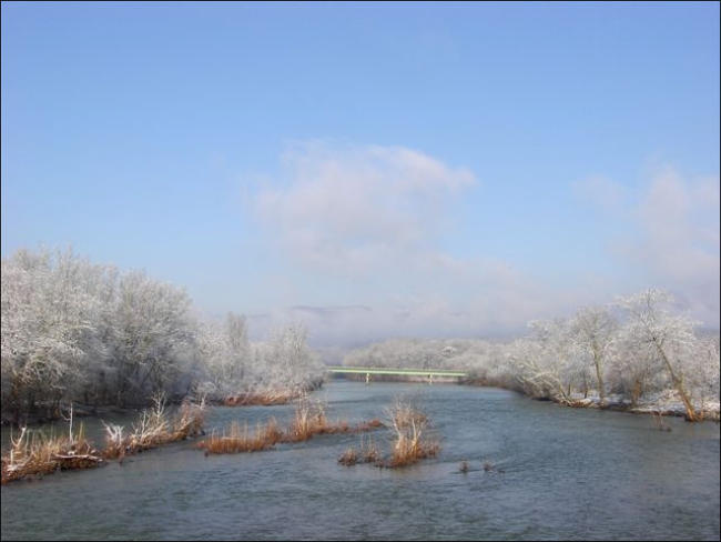
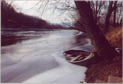
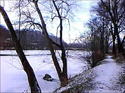
In the winter the waters can freeze over, or the snow can cover the ice, trees and ground.
(Click on photos below for larger view)
It would be hard to measure the effect on those who’s daily lives lived and worked around the Greenbrier River. One thing for certain, they will never
forget it.
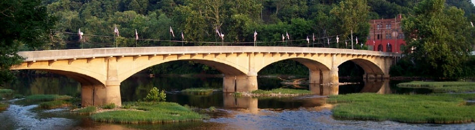
In
1881
the
first
bridge
to
cross
the
Greenbrier
in
Alderson
was
built.
No
longer
would
townspeople
traveling
back
and
forth
be
hampered
by
the
various seasonal hazards the river would bring.
According
to
the
Encyclopedia
West
Virginia,
the
state
waters
harbor
a
diverse
assemblage
of
fishes.
There
are
154
native
species
in
our
lakes,
streams,
and
rivers,
but
due
to
many
accidental
or
intentional
introductions,
the
total
number
present
actually
stands
at
179.
These
species
are
distributed
among
24
different
families,
with
about
75
percent
found
in
just
five
families.
These
five
families
are
the
carps
and
minnows
(60
species),
perches
(31),
suckers
(18),
basses
and
sunfishes
(14),
and
catfishes
(12).
Of
course,
not
all
of
these
fish
are
found
in
the
Greenbrier,
but
certainly
enough to supply fish as a source of food.
In
addition,
you
can
find
crayfish,
lizards
and
one
particular
salamander,
the
“water
dog”,
officially
known
as
the
Hellbender.
Hellbenders
are
large
aquatic
salamanders
that
may
reach
24
inches
in
length.
They
are
generally
brown
with
irregular,
dark
spots
on
the
back.
Unique
characteristics
include
a
flat
head
with
small
eyes,
wrinkled
folds
of
skin
between
the
front
and
hind
limbs,
and
gill
slits
that
persist
throughout
life.
An
awesome
looking beast the first time you see one in crawling on the river bottom.
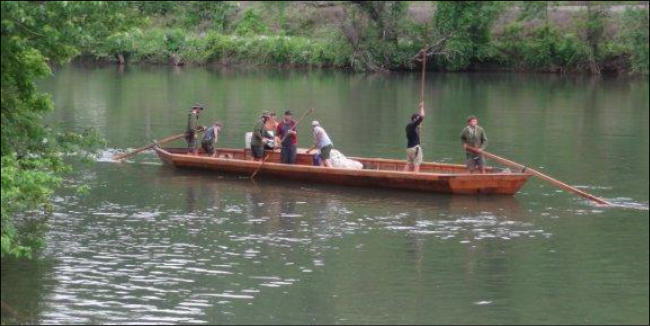
2012
marks
the
200th
anniversary
of
that
1812
survey
expedition
led
by
Supreme
Court
Justice
John
Marshall.
The
expedition
trip
was
re-created
by
Andrew
Shaw,
and
his
crew
of
batteau
enthusiasts
with
their
hand
built
43
foot
by
7
foot
batteau
named
the
Mary
Marshal.
It
is
not
known
if
they
use
some
of
the
“batteau
canals” which still exists to day. (Click on photo for larger view)