|
BATOFF MOUNTAIN
is in southern West Virginia and stories abound that start out like
this, " I was dragging a coal-truck load of logs, truck load of
gravel, up/or down Batoff Mountain when"-- now the important part of
the story is about to begin. It may be a tragedy or it may become a
self-nominated story of heroism at the wheel, shifting loads,
blowouts, black ice covered curves, ignorant "other" drivers, what
ever it is, it will be interesting , at least the first two or three
times one hears it. Many of these things have happened and will
continue as long as roads and driver co-exist!
Do any of you know how Batoff Mountain became to be known as Batoff
Mountain? A clap on the back if you guessed it. What was the first
form of transportation in Western Virginia, and present West
Virginia. Was it not foot traffic, "shanks mare' if you insist.
Possibly leading a mule or a horse! Later, most likely a semblance
of a wider path would result on the most used trail and first narrow
two-wheeled cart pulled by either human or animal finally was able
to traverse the mountains bringing ever more merchandise to the
scattered settlers.
We need to be aware that the heroes of the frontier were more than
the scouts and the hunters, they were the women that accompanied
them, and the children they raised. Just as heroic were the peddlers
who, at first on their backs and then with horse and wagon actually
brought civilization to the west of the Alleghenies!
"Batoff" was an Anglo-American-Virginia mispronunciation of the
French word "boat"! Which itself was likely a corruption of the
French word "Batteaux", into ' Batteau' and Batteau is what we'll
use because if it was good enough for them it will do just fine for
us! I wish we had more stories of them.
The French and British were in Canada just about the time the
Colonists on the Eastern Shore were beginning to meander very slowly
westward. Down the Shenandoah Valley and into the southern part of
the state toward the "Big Divide" near the near the present Bristol,
Va., Tenn. area.
"The Peddlers, the "Trappers" and the early settlers began to need
more ways to transport their goods both ways. The Canadian and
French Batteau adapted nicely to the many rivers draining the
Shenandoah and Potomac mountain ranges, Little rivers like the Cow
Pasture and Jackson and Maury on the Eastern side and it was just a
hop and jump over the top of the Blue Ridge to the Gauley and
Greenbrier and on to the New River and thus the Ohio and the
Mississippi! The 'Batteau" found a home! From the headwaters of the
Greenbrier in Pocahontas county near Durbin, through Ronceverte and
Alderson down the river to meet the mighty New river at Hinton.
The Batteaus were seldom more than 60 feet long by 8 feet wide and
seldom more than 3 feet deep. The larger one generally had a crew of
5 or 6 ; 4 "polers", an extra man and a steerer. The cargo was
carried generally in 12 barrels placed on their sides on beds of
branches in the bottom of the boat and then covered with canvas for
protection from the weather and the wet, because they were going to
get wet even in the best of voyages.
Many Batteaus were as short as 30 feet , required less crew and
could handle many of the streams and rapids better. My guess would
be that would have been the majority of Batteaus coming through
Alderson. Although Several years ago two replica reenactment boats
floated thorough Alderson on the way to Hinton and
New River. Little publicity was made so the people who saw them was
fewer than would have liked.
When the Batteaus encountered white water rapids that demanded
prudence, the boatmen would often lower the boats from on shore with
the use of ropes, Much as modern canoeists sometimes must portage
overland around treacherous parts of a river.
Slowly and as river traffic increased they built "Batteau Channels",
around many of the rapids, at least three are visible from the Upper
Bridge in Alderson: just above the bridge and another about a couple
of hundred yards below behind the old Alderson Hotel site, on the
semi-island thus formed likely was located the Clark and Howell
window and door sash plant! Another is like just under the North
side of the bridge and likely served the merchants that were on the
north shore long before the bridge existed. The Rapids below Town at
Johnson
Island appear to have a Batteau Channel on the north side of the
river from the upper end to where Muddy Creek enters. one might
logically think perhaps the Batteau navigated up Muddy Creek to the
Mills and the several stores at Palestine and at Blakers Mill.
Another very well defined Batteau Channel is one the South side of
the river, opposite the long series of rapids near Camp Greenbrier.
It has always been called "White Rock' and fishermen and boaters are
very familiar with it. I certainly am, Bunk Rowe or another fool,
and I hopped a slow freight to hitch a ride, It had sped up
considerably when time came to jump off, I didn't land to
gracefully!
|
 |
|
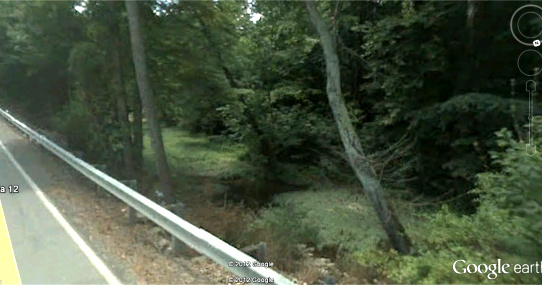
A section of the
"Batteau Channel" located just below the new bridge and
the Wheel Restaurant, on Rt. 12 looking east. |
|