|
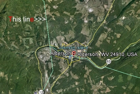
In the above photo
you can see the sky blue line, which is the present
border for Summers County. While going in a north-east
direction, it take a sharp turn northward to where it
again goes north west, bypassing Alderson. |
|
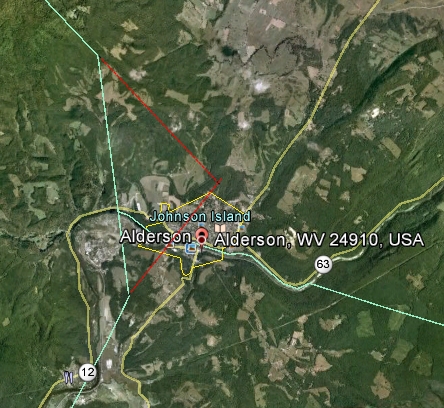
This photo shows an
artist's (me) conception of a possible position of the
original border line (the
red line) that was mapped out in the Act of
the Legislature in 1871 between Summers and Greenbrier
Counties. This route would not encompassed all of
Alderson today, however in 1894 would have gotten most
of it. Who knows? Some of us might have been from
Summers County, instead of Greenbrier or Monroe. |